Levelling
of Great Britain
[2GL Transcription]

| Ordnance Survey's Levelling of Great Britain |
[2GL Abstract] [2GL Transcription] |
|
 Images held at
the National Archives, Kew
Images held at
the National Archives, KewThese images are copies of the Glass Lantern
Slides held at the National Archives, Kew. (others)
They are made available here purely for research
purposes, and should not be duplicated or redistributed.
They were
published by the Ordnance Survey and as such covered by Crown
Copyright.
“Reproduced by kind permission of Ordnance Survey © Crown Copyright NC/2004/35281”
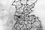
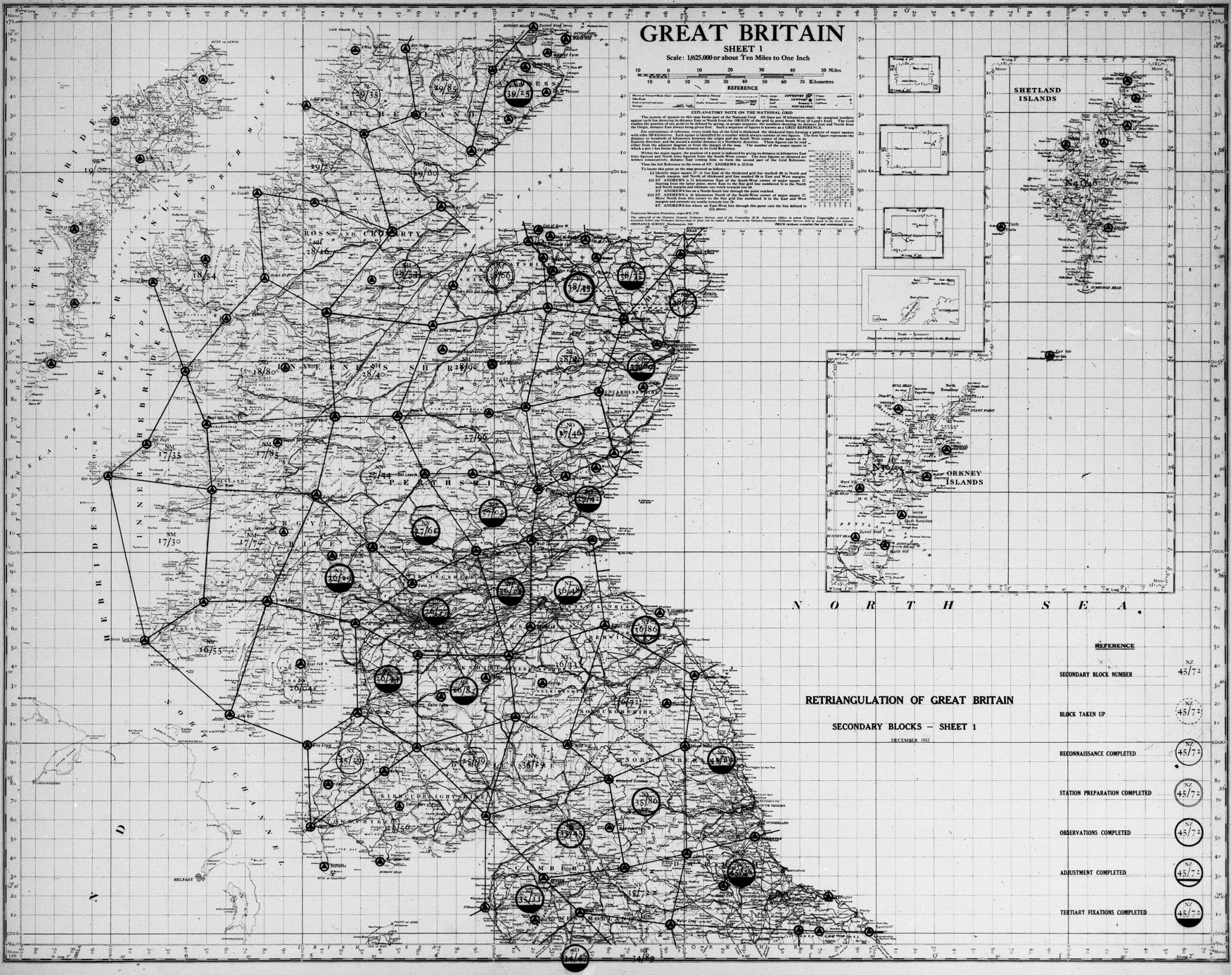
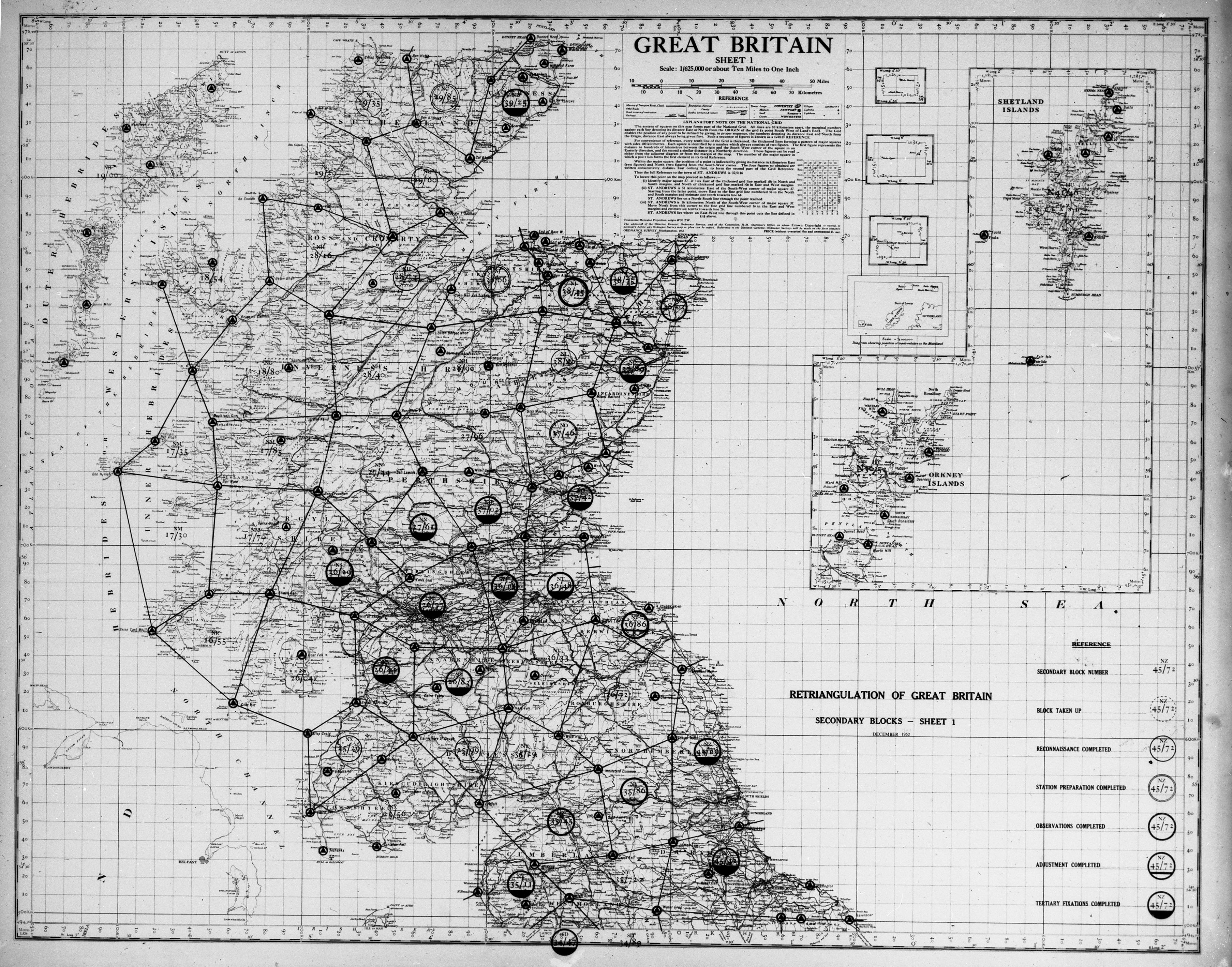
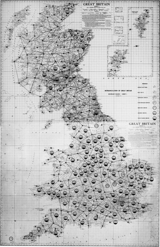
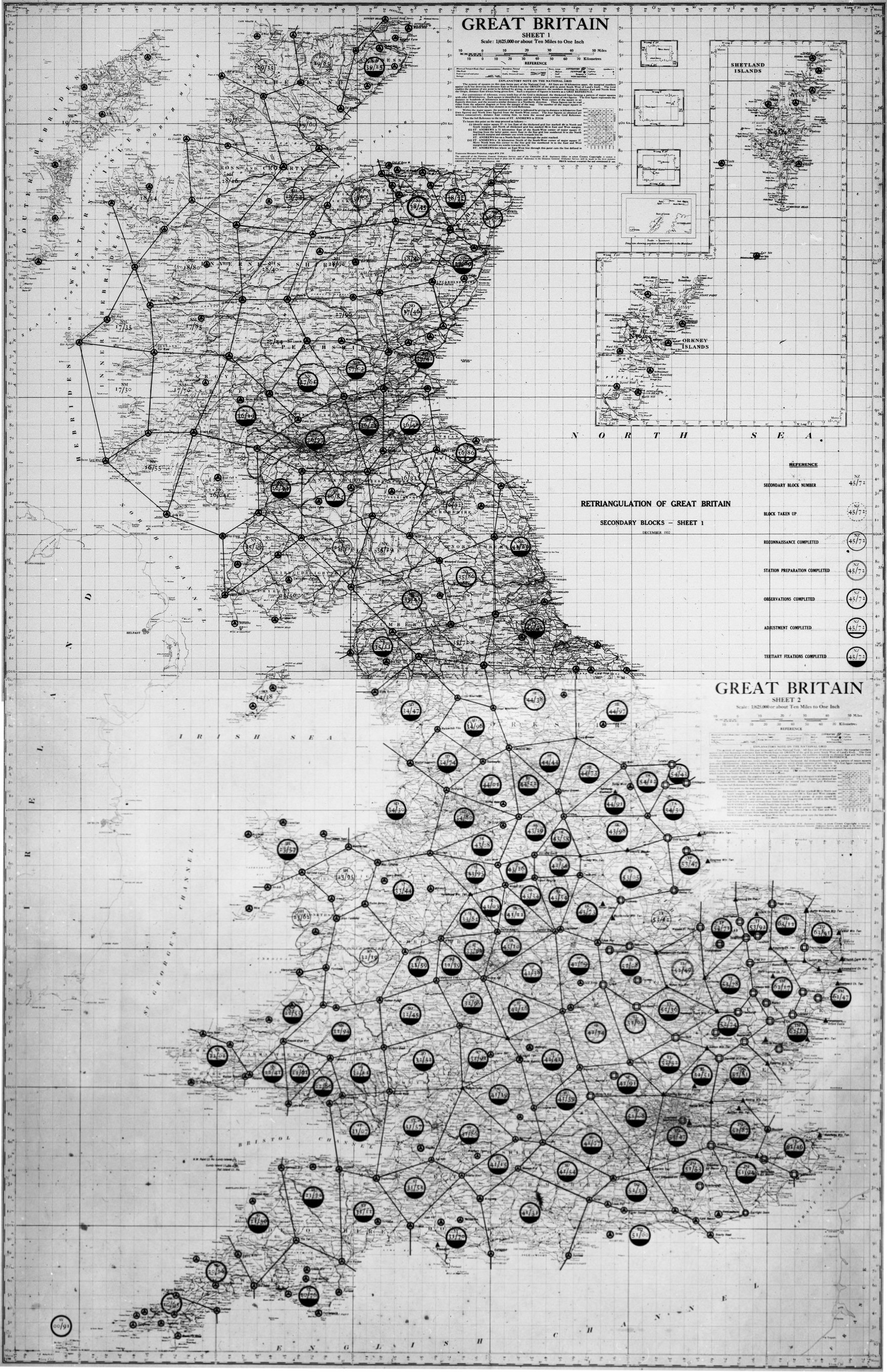
| Secondary Triangulation blocks Scotland: diagram dated 1952 showing secondary triangulation blocks Sheet 1 Scotland at a scale of 1:625000 or 10 miles to an inch | |
 [Click to view] |
OS
51/28 1950 Jan 01-1968 Dec 31 [NEW: Interactive Viewer] or 50% (833Kb) 100% (2,253Kb or 2.2MB!) View Blowup of date of base mapping (18Kb) See modern digitised version of this map - Base map dated 1942 - OS Reference number L526 printed in bottom left hand corner - Key indicates progress in each of the secondary blocks, from 'Block Taken Up' to 'Tertiary Fixations completed' - similar to an earlier map referred to in [1] p137 - Retriangulation of Great Britain: Secondary Blocks: December 1950 (... in two sheets at 1:625,000) |
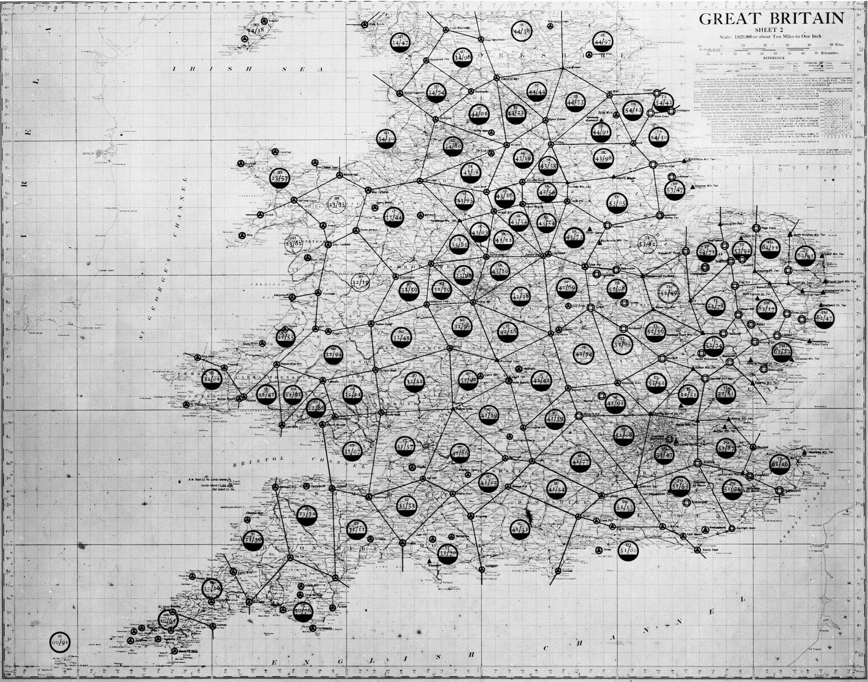
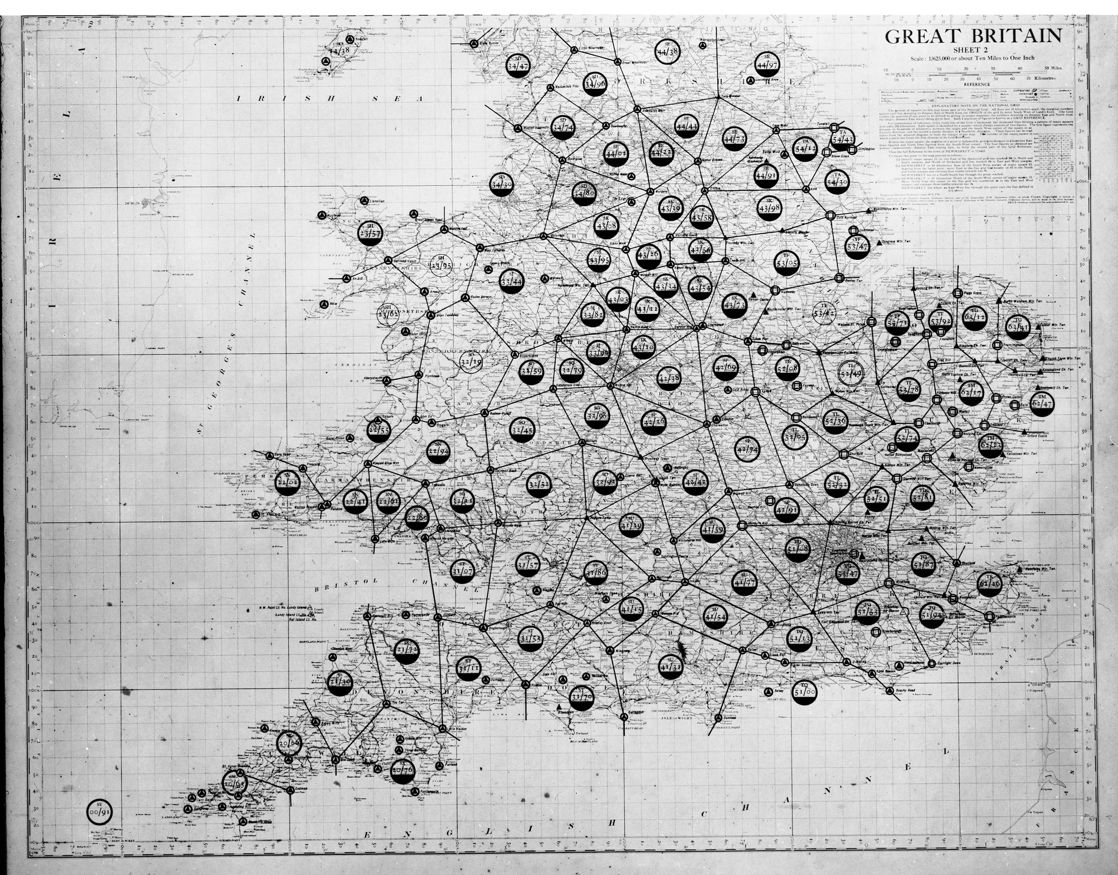
| Secondary Triangulation blocks England and Wales: diagram dated 1952 showing secondary triangulation blocks Sheet 2 England and Wales at a scale of 1:625000 or 10 miles to an inch. | |
 [Click to view] |
OS
51/29 1950 Jan 01-1968 Dec 31 [NEW: Interactive Viewer] or 50% (801Kb) 100% (2,272Kb or 2.2MB!) View 28/29 joined (23%)(238Kb) [@50% (1,361Kb)] See modern digitised version of this map Sheet 2, but no title, key or dates .. - Base map dated 1942 - OS Reference number L795(?) printed in bottom left hand corner - Same progress symbols as Sheet 1, but apparently a later date ... - further trig symbols - assumed as follows: solid triangle with no surround = church towers and water towers solid triangle in a circle = normal trig pillars hollow square in a circle = trig pillars over which Bilby towers were erected for observations hollow triangle with a '+' symbol = intersected point - e.g Air Beacon - similar to an earlier map referred to in [1] p137 - Retriangulation of Great Britain: Secondary Blocks: December 1950 (... in two sheets at 1:625,000) |
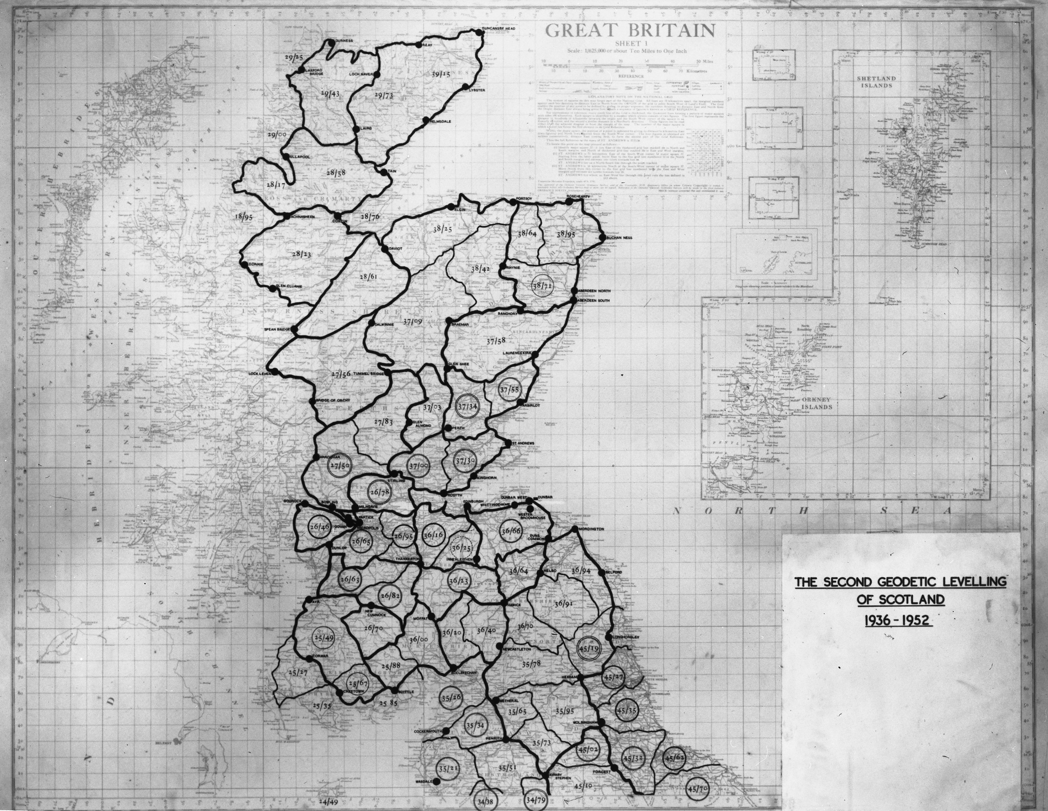
| Second Geodetic Levelling Scotland 1936-52: map showing levelling | |
 [Click to view] |
OS
51/405 1950 Jan 01-1968 Dec 31 [NEW: Interactive Viewer] or 50% (576Kb) 100% (1,575Kb or 1.6MB!) - Base map dated 1942 (as OS 51/27 & /28) - no obvious OS reference number - marked up along the roads rather than just 'linking' the FBM's - also showing Secondary lines! - naming for tertiary 'blocks' as well as progress symbols similar to OS 51/27 - similar to a map referred to in [1] p134 - Newlyn Levelling: Diagram of Levelling Blocks (two sheets at 1:625 000) - 1942 |
| Missing at
Transfer -
OS
51/406 believed (hoped?) to be the southern sheet... |
|
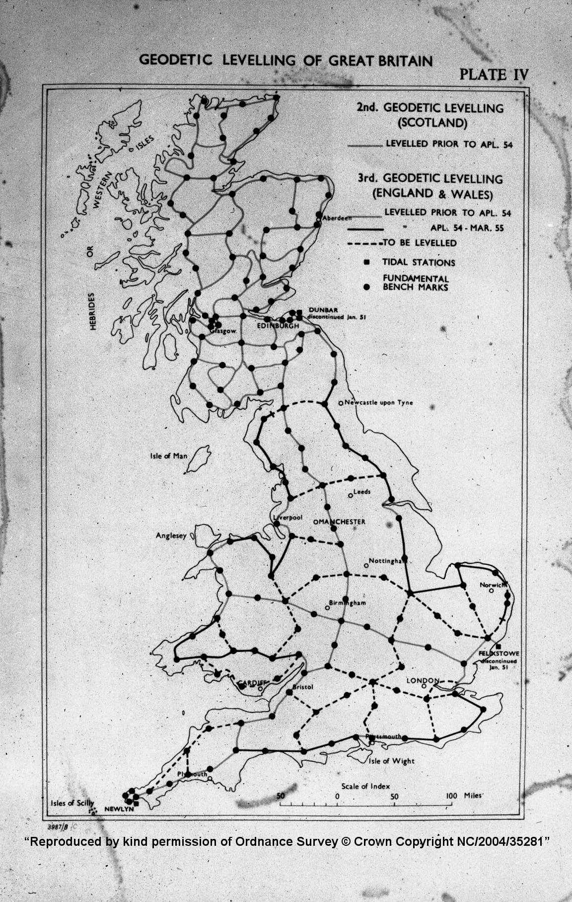
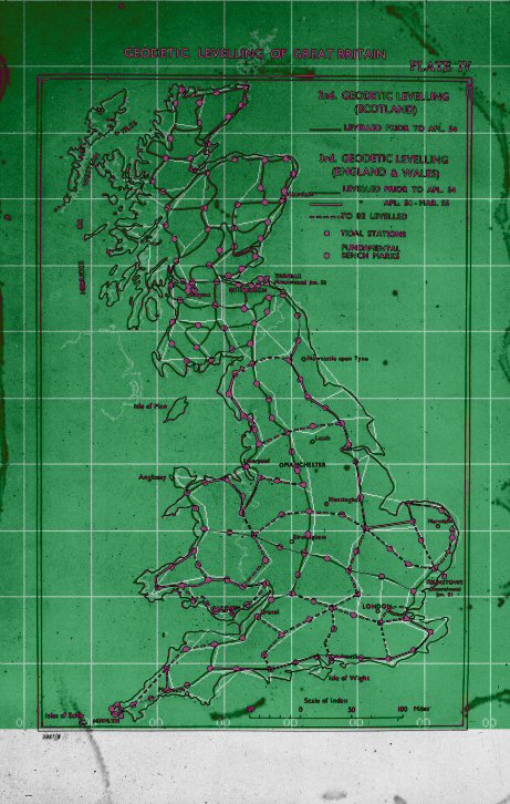
| Third Geodetic Levelling: map showing levelling of Great Britain showing tidal stations, fundamental bench marks, the second levelling of Scotland and the third levelling of England and Wales labelled plate IV source unknown, circa 1950s | |
 |
OS
51/408 1950 Jan 01-1968 Dec 31 View at 50% (760Kb) Compare to our 3GL map (109Kb) (our lines in white) - diagram over coastline - OS reference 3987/B/C - presumably there are two previous versions out there ... - Showing 2GL of Scotland (as FBM links) - Progress of 3GL in England & Wales - Prior to Apr '54 / Apr 54 to Mar 55/ to be levelled “Reproduced by kind permission of Ordnance Survey © Crown Copyright NC/2004/35281” |
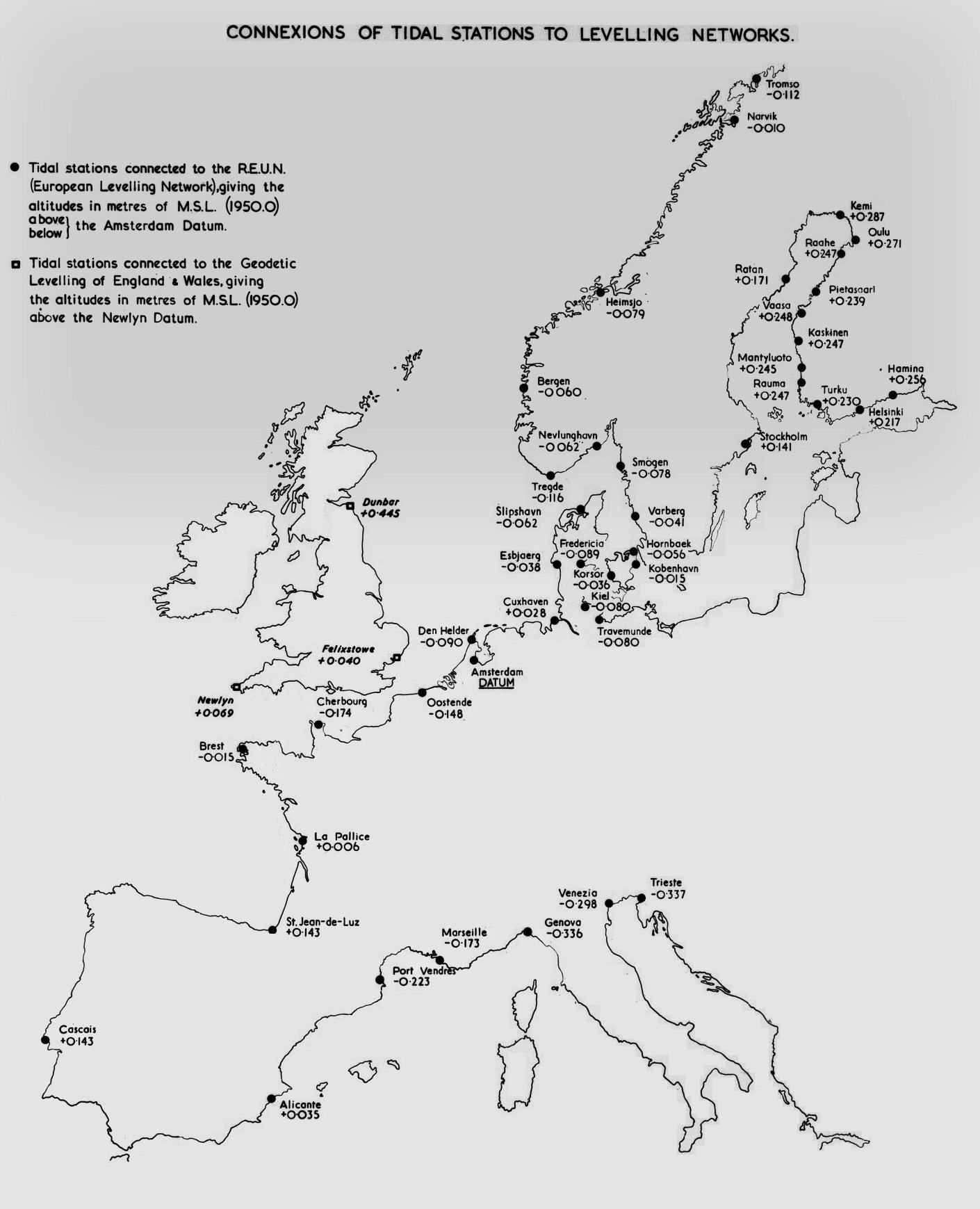
| Connections of tidal stations to levelling networks: map of Britain and Europe showing the connection of tidal station to the European Levelling Network, circa 1960 | |
 |
OS
51/409 1950 Jan 01-1968 Dec 31 (artificial background colouring introduced to reduce the filesize) View at 50% (234Kb) View Original at 30% (234Kb) - European coastline showing tidal stations with altitudes - no levelling lines though. “Reproduced by kind permission of Ordnance Survey © Crown Copyright NC/2004/35281” |
[1] - Roger Hellyer, The 'Ten-Mile' maps of the Ordnance Surveys (CCS 1992)