|
|
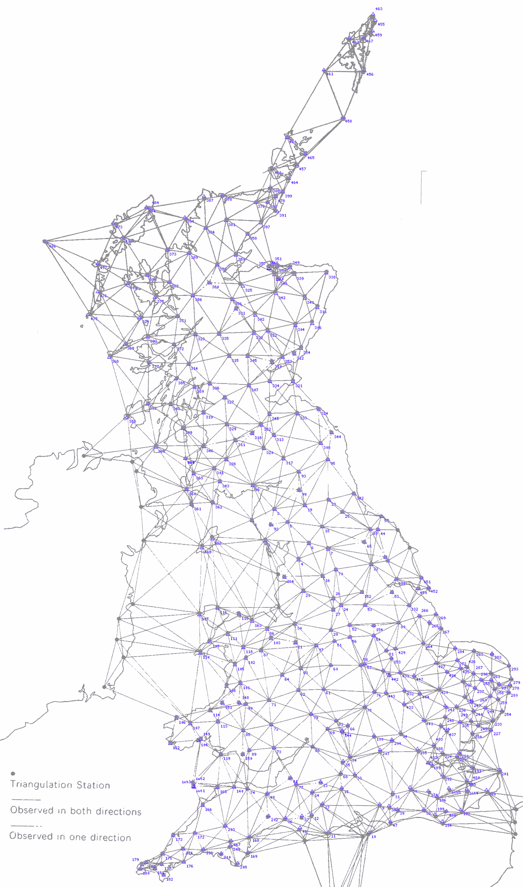
| JB Harley Diagram in Gray. Digitally plotted primary points with PP no in blue. | Download Full Image (279kb) |
This is made available here purely for research purposes, and should not be duplicated or redistributed.
This is Figure 3 From 'Ordnance Survey Maps - a descriptive manual' by J B Harley which was published by the OS in 1974, and overlayed with Trigpoints from Re-Triangulation of Great Britain
“Reproduced by kind permission of Ordnance Survey © Crown Copyright NC/2004/35281”